Wikus Engelbrecht
For 147 years, a small geometrid moth, Drepanogynis insciata, was thought to be extinct. Then photographs uploaded to iNaturalist between 2020 and 2023 showed it was still alive in the Western Cape. The finder was not on a research expedition: just a nature lover, with a camera, who shared what he saw.
The crowdsourcing concept behind iNaturalist is why the platform has become one of the world’s most important sources of biodiversity information.

Scientists estimate there are over 8 million species on earth, but currently we’ve only described over 2 million. To date over 550,000 unique species have been recorded globally on the platform, including hundreds of new-to-science species that have been formally described with the help of community observations, according to the 2025 iNaturalist impact review.
Many new species are first photographed by users before being named by taxonomists, and data from these citizen science observations have contributed to more than 7,000 published scientific papers. But with indigenous plants being stripped from South Africa’s veld by organised crime; can these discoveries be kept safe?
Could iNaturalist be used to help poachers? This is a common question that deserves scrutiny.
The answer has three parts: what the platform does automatically to protect sensitive species, what international best practices say about sharing biodiversity data, and what observers can do to cover the remaining gaps. Safeguarding is not an afterthought to citizen science – it is what allows the data to be shared at all.
What is iNaturalist
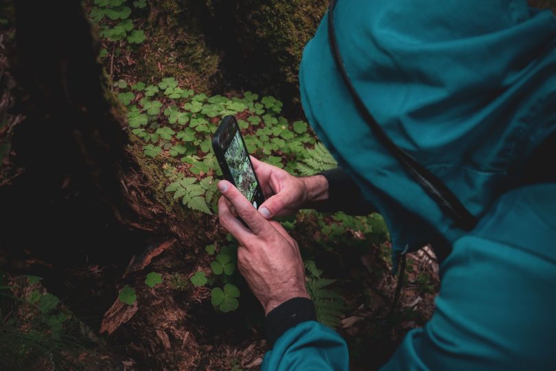
iNaturalist is a global platform where users upload photos or sound recordings of organisms as evidence that something was at a particular place and time. When an observation is uploaded, an artificial intelligence can suggest identifications from the media and location. The observer reviews the suggestions, and a community of identifiers refines the result to the finest level the evidence supports.
Quality control is built into the process. An observation reaches “Research Grade” only when it has a date, a location and sufficient photographic or audio evidence, and when at least two people have identified it and more than two-thirds of them agree on the species.
Observations that fall short stay in the “Needs ID” or “Casual” categories. Each record is a collaboration between observers, identifiers and curators – and observers can also group records into projects around a region, a species group or a research question. Observers keep control of their own data, choosing the licence for their photos and deciding whether the location of any record is open, obscured or private.
What the data is used for
The scale of iNaturalist’s contribution is striking. Guidelines and best practices for the scientific use of global iNaturalist data published during September 2026 in the journal BioScience reports that at least 80% of recent contributions to the Global Biodiversity Information Facility [GBIF] come from participatory-science communities.
iNaturalist offers the broadest geographic and taxonomic coverage of openly available biodiversity observations. The number of observations has grown by a mean of 50% a year over the last decade.
Publications using iNaturalist data have increased tenfold in five years, and the data are increasingly used in policy work such as environmental impact assessments – sometimes held to a higher standard than professionally collected datasets.
South Africa shows what this looks like on the ground. SANBI, the national biodiversity institute, is the platform’s national focal point and iNaturalist observations contribute to Red List assessments.
In SANBI’s 2024/25 reporting, volunteers of the Custodians of Rare and Endangered Wildflowers [CREW] recorded three plant species new to science and rediscovered four thought to be extinct in the wild.
This observational data has become so widespread and authoritative that voids in coverage are conspicuous. The BioScience study’s authors warn that a lack of records is not proof that a species is absent, and found 28 cases in environmental impact reports where missing iNaturalist records were – absurdly – used to claim exactly that.
The remedy for this weaponised absence of evidence is more observers in more places, recording more species.
Sharing responsibly
iNaturalist observations carry location data, immediately raising questions around protecting sensitive species. In South Africa the illegal collection of plants, especially succulents, is a serious problem.
Since 2018, more than 2.5 million illegally harvested plants have been seized in the Western Cape and CapeNature estimates that less than a quarter of the illegal trade is intercepted.
Veteran South African iNaturalist users acknowledge that poachers have used the platform in the past. Others in the anti-poaching community note that poachers can use any online platform that lets people upload and share content, while actually depending on more traditional methods such as extortion or payoffs to locals.
No tool can promise zero risk. What counts is how effectively the platform and its community curtails misuse.
Safeguards built into the system
iNaturalist helps prevent poaching by hiding the exact GPS coordinates of sensitive, threatened or endangered species from public view, using both automatic and manual tools.
Species on its sensitive or threatened list are obscured automatically, so public maps show a randomised area instead of the true spot, and only the original observer and authorised users can see the exact coordinates. Observers can also obscure any record themselves if they think a species is vulnerable to harvesting or poaching, or set it to “Private,” which removes the location from public maps and community identification mapping – though at the cost of its research value.
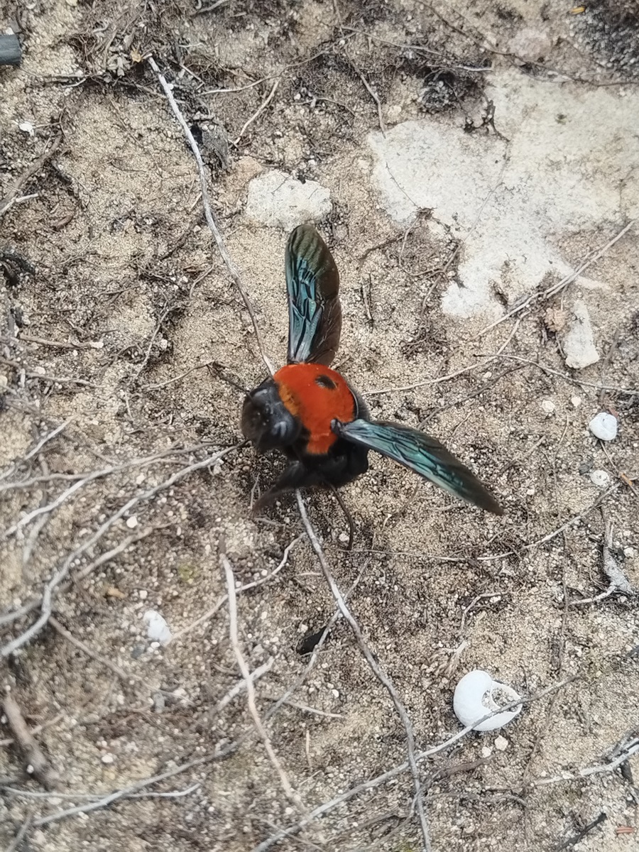
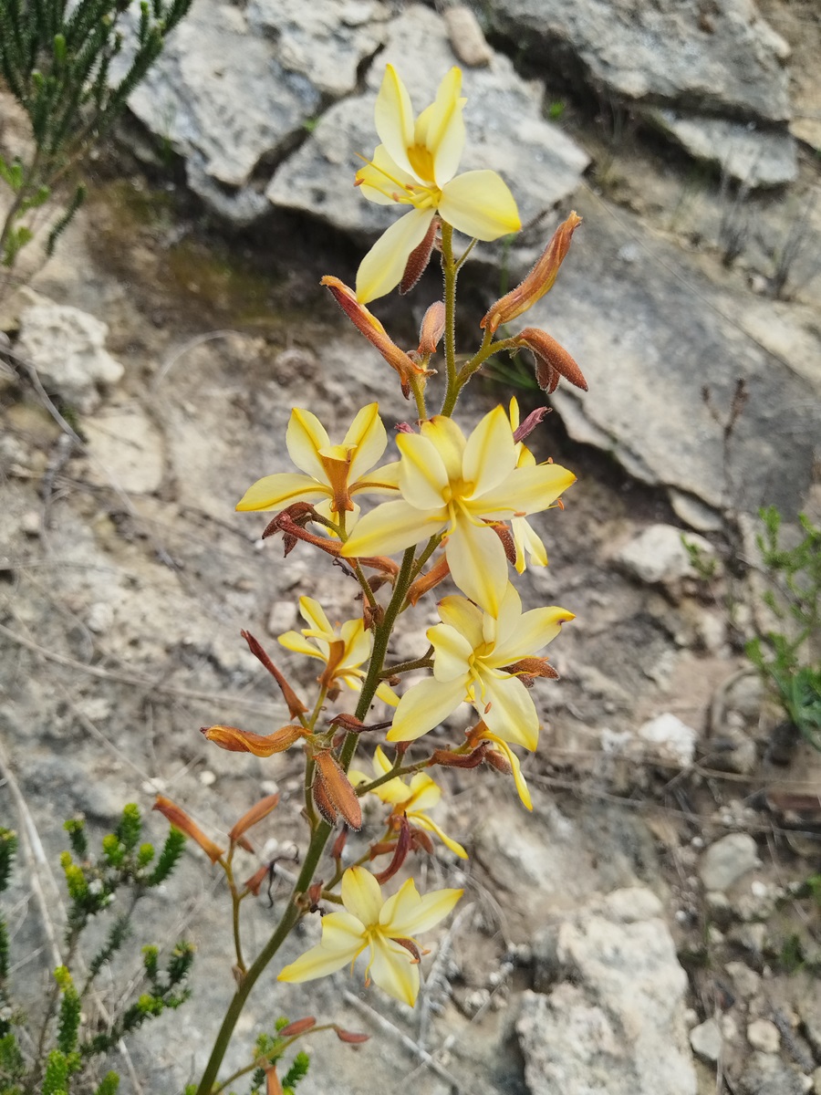
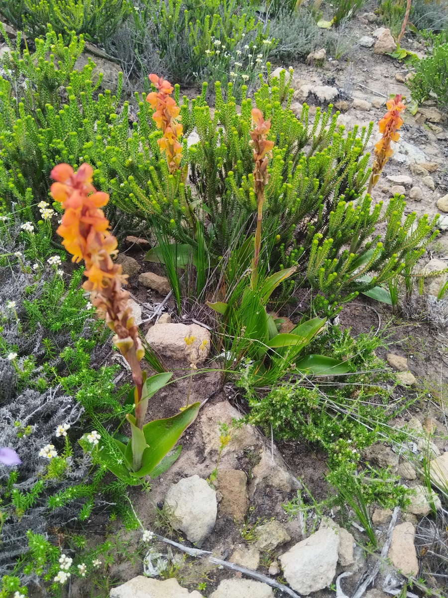
The list of automatically obscured species is kept current by curators and users who flag sensitive species that should be added.
Automatic obscuring of sensitive species. Taxon geoprivacy hides the precise location of species considered vulnerable to harm from disclosure. It applies even when an observer uploads with an open location. The platform keeps the true coordinates but publicly displays a random point within a larger grid cell. At the Garden Route’s latitude, such a cell covers roughly 400 square kilometres.
Blurred dates. According to South African users, the public date of an obscured observation is reduced to month and year, which makes it much harder to follow an observer’s trail on a particular day.
Observer controls. Any observation can be set to obscured or private. Private records share no location publicly and are not passed to GBIF. This is the tool for scenarios that an automatic list cannot anticipate – such as a nest, a tiny population or a single vulnerable plant.
Trusted access. Hidden coordinates remain available to the observer, to individuals or projects the observer trusts, and to network nodes (the regional or national partners that run localised versions of iNaturalist) for users who affiliate with them. Researchers given this access are specifically warned not to reproduce hidden coordinates in publications or data releases. Expert users recommend joining conservation projects so that trusted curators can still use sensitive data.
Community-managed lists. Curators and conservation stakeholders contribute to which species are obscured. Taxa with a high collection risk can be added even when their conservation status is modest.
This approach follows the principles in the GBIF’s Current Best Practices for Generalizing Sensitive Species Occurrence Data:
Start from openness. Freely available environmental information generally benefits the environment through awareness and better decision-making, so restriction is the exception.
Assess before restricting. A taxon is sensitive when it is subject to a harmful human activity, when releasing the data would raise the risk, and when the information is not already public. A list of sensitive species therefore differs from a list of rare ones.
Says Dr. Tony Rebelo, former researcher at SANBI, and a champion for the Protea Atlas Project and the the iNaturalist citizen science programme in southern Africa, “iNaturalist as an international site has to cope with poaching worldwide: this is not a local South African phenomenon, it occurs in Mexico, California, Australia, Namibia, and even in China. Consequently, considerable expertise has been devoted on the platform to this issue.
“South Africa distinguishes threatened Red List species from Sensitive species, which are threatened by their localities being known. Species threatened because of climate change, overgrazing or urbanisation do not need their localities obscured: in fact, this could increase the threat on the species. Obscuration is only needed if the threat such as harvesting, collecting or poaching can benefit from the locality information.”
“Most people don’t need to worry, but some advice in dealing with seriously poached species is not to include landscape shots with easily identifiable landmarks, and upload sensitive species in a separate batch from other observations taking care not to load them in the sequence seen.
“It is important to remember that obscured data are very hard to extract from iNaturalist. For all intents and purposes, the data are useless for research, red listing, inventories, conservation management, environmental impact assessments or anything requiring data at a finer scale than 25km by 25km squared.
“The cost of obscuring data needs to be weighed against the cost of exposing the locality data to poachers. Obscuring data also means that volunteers cannot protect them, making it harder to detect and police poaching or to protect sensitive habitats,” he continued.”
The limits, stated plainly
Obscuring covers only the data the platform controls. It cannot stop an observer from revealing a locality through a photograph’s background, a caption or a social media post, or stop someone from combining several records. The weak point is in human behaviour.
Says Dr. Christina Mars of the Still Bay Herbarium, “A positive thing that has changed is that the exact date is now also obscured, making it very difficult to follow a person’s trail on a particular day. Of course, if you put a lot of effort into it, you could probably still track down the trail of a rare plant here and there, but it is no longer easy.
“As for poaching there is more reliance on people from areas that are known for certain sought-after rare plants: people who hike in the mountains, look for traditional medicine or medicinal plants, and rare plants to sell for money. With that said there is sometimes a blind eye turned towards indigenous medicine collectors, and they are often a point of connection for the criminal syndicates that cause major poaching damage.”
“The big problem, however, is also that many poached plants end up in botanical gardens and with growers who do not have the experience, appropriate location or training to keep the plants alive. The crisis of poaching has to do with financial desperation and greed. iNaturalist does what it can to prevent poaching.
“If you found the plant yourself, you will always see its correct GPS coordinates. So the issue is with people, not the programme. There are often suggestions that a plant’s GPS should be obscured, and this has happened to me with new species that have not yet been described,” she concluded.
The habits of a responsible observer
- Know what is targeted. Succulents, orchids, caudiciform plants and certain bulbs are well-known targets, and fashions change. Learn which species near you are in demand before you upload.
- Ask first. Talk to the landowner, reserve manager or CapeNature about where and when to record and which plants are sensitive. Reserve managers sometimes ask for specific records to be obscured, and some experienced observers deliberately withhold certain species altogether.
- Check the frame. Avoid recognisable landmarks, and keep directions, place names and track details out of photos, captions and comments.
- Break the sequence. Upload sensitive species in a separate batch, not in the order you found them.
- When in doubt, obscure, then stay connected. Join the relevant South African projects so trusted curators can see your true coordinates.
- Look and leave. The aim is documentation, not collection.
Training and awareness matter more than any single setting. Observers who understand what is at stake make better decisions than any system default can.
Sandra Falanga, an environmentalist and conservationist known for her work with the Botanical Society of South Africa and CREW said, “Plant poaching is a tug of war and a heartache. iNaturalist has been used to poach plants, and the police have confirmed it. At the same time, much of the information is visible elsewhere, and the people doing the poaching often already know where the plants are.
“It also matters whether the poaching is for livelihoods or for a market, and fashions change: one year it is small succulents, another it is moss or aloes, and now some of the caudiciform pelargoniums. People need to learn which plants and areas are targeted, and education is essential. Training in iNaturalist and plant knowledge needs to be promoted. If you are unsure, err on the side of caution and consult an expert.”
She continued, “iNaturalist has tightened its security. On a computer, an obscured observation no longer shows the month, date or time, though the app once showed some of that information, which made it possible to match records and sleuth out locations. If you photograph along a route, uploading out of sequence makes your trail harder to follow.
“You cannot prevent poaching, but you can prevent carelessness through training, exposure and common sense. That means close cooperation with CapeNature, the police and the Wildlife Crime Information Network, plus reporting, enforcement and media attention. We should harness the positive; point newcomers to the hundreds of species around them that nobody is likely to take, and encourage passion for nature and awareness.”
Shaun Swanepoel, a prominent South African naturalist, citizen scientist and iNaturalist superuser – extensively documenting biodiversity along the Garden Route – said, “iNaturalist has specific safeguards intended to prevent publicly available observations from being used to locate sensitive species for purposes such as poaching, illegal collecting, or deliberate disturbance. The principal safeguard is taxon geoprivacy.
“When a species or other taxon is considered vulnerable to harm if its precise location is disclosed, iNaturalist can automatically apply taxon geoprivacy to observations of that taxon. This means that even if an observer has submitted an observation with an open location, the precise coordinates are not made publicly available. Observers can also manually obscure or make an observation private where they believe there is a risk that is not adequately covered.”
He continued, “Geoprivacy is a significant barrier to obtaining the precise location from the iNaturalist record itself, but it is not an absolute guarantee that a determined person cannot work out where an organism occurs.
“This is also important from a conservation perspective. There are circumstances where accurate distribution information can be highly valuable to conservation organisations, researchers and land managers. iNaturalist therefore separates public access to the location from controlled access for legitimate conservation and research purposes.”
“The system is specifically designed to reduce the value of iNaturalist as a source of precise locations for poachers and illegal collectors, while retaining the underlying information for legitimate scientific and conservation use.”
“Poaching is an analog trade that has existed since antiquity: today it still relies primarily on traditional tracking methods, local networks and old-fashioned skullduggery, rather than modern technology. iNaturalist is a platform for discovery, science and education – not a convenient infrastructure for vice. Living treasures, once detected by any means, are always going to be vulnerable to theft – but citizen science tools are not a sine qua non for poaching and with current pressures from climate change, human development and unprecedented biodiversity loss; the prevailing need is to study what we have and attempt to conserve it, before it’s lost.
An invitation for new observers
A species nobody has documented cannot be assessed, defended or prosecuted over, and the people in the field who photograph, identify and report responsibly are a vital part of the conservation community. With automatic system safeguards combined with sensible user practices, nobody should feel dissuaded to join due to location-sharing apprehensions. South Africa is already a world leader in iNaturalist.
In 2025, its participants contributed 103,380 observations of 12,434 species to the Great Southern Bioblitz [GSBB] – the southern hemisphere’s biggest annual citizen science biodiversity survey – more than any other country and over a third of all observations recorded globally.
This year’s bioblitz runs from 27 to 30 November, and the Wild Rescue nature reserve is organising the campaign for the Garden Route district. It will host practical iNaturalist workshops at the reserve on Saturday 28 and Sunday 29 November, where newcomers can learn to use the platform on the reserve’s fynbos trails. Anyone anywhere with a smartphone can join the bioblitz, and every record adds to the evidence that conservation work depends on.